Upsc insights
Welcome to my UPSC learning space — where I share clear, concise, and thoughtful blogs on Polity, History, Geography, and Economics. Learn, revise, and stay inspired for your civil services journey.
Welcome to my UPSC learning space — where I share clear, concise, and thoughtful blogs on Polity, History, Geography, and Economics. Learn, revise, and stay inspired for your civil services journey.
Welcome to my UPSC learning space — where I share clear, concise, and thoughtful blogs on Polity, History, Geography, and Economics. Learn, revise, and stay inspired for your civil services journey.
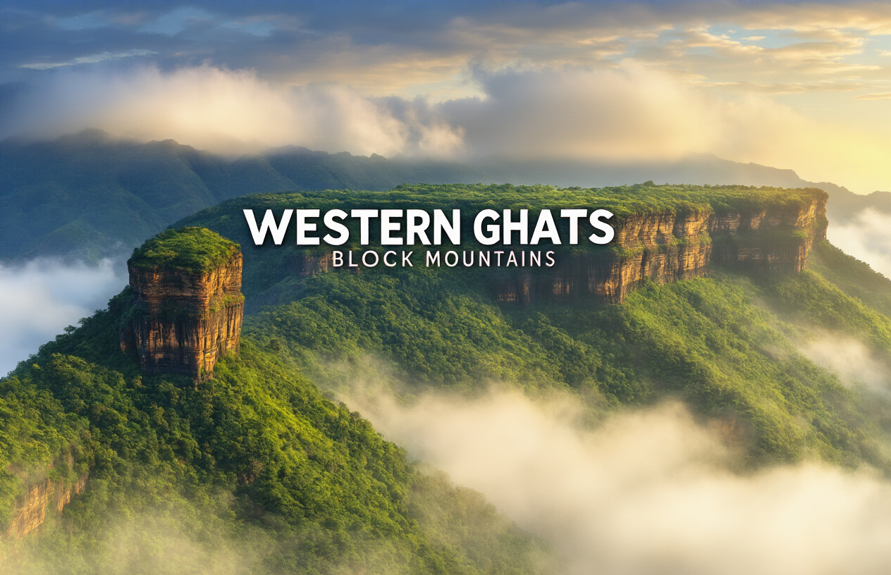
The Western Ghats are called block mountains due to their formation through tectonic uplift, which has resulted in their steep escarpments and flat-topped plateaus. This classification underscores the significance of geological processes in shaping their unique landscapes and ecosystems, highlighting why western ghat are called block mountain.
The Western Ghats are called block mountains because they formed when massive sections of the Earth’s crust were pushed up along fault lines millions of years ago. This mountain range stretches along India’s western coast and shows all the classic signs of block mountain formation.
Understanding why are western ghats called block mountain is essential for grasping the significance of this mountain range.
In this post, we will explore the answer to the question of why western ghat are called block mountain.
This guide is perfect for students, geography enthusiasts, and anyone curious about how India’s famous mountain chain came to be. We’ll break down the science without getting too technical.
Here’s what you’ll learn:
• What block mountains actually are and the step-by-step process that creates them
• The geological story of how the Western Ghats formed over millions of years
• Clear evidence that proves these mountains fit the block mountain category
• How Western Ghats compare to other mountain types like the Himalayas
By the end, you’ll understand exactly why geologists classify the Western Ghats as block mountains and what makes them unique among India’s mountain ranges.
So, why are western ghats called block mountain? The answer lies in their unique geological formation.
This section will clarify why are western ghats called block mountain and the processes involved.
In this article, we will explore the question: why are western ghats called block mountain and delve into their fascinating geological features.
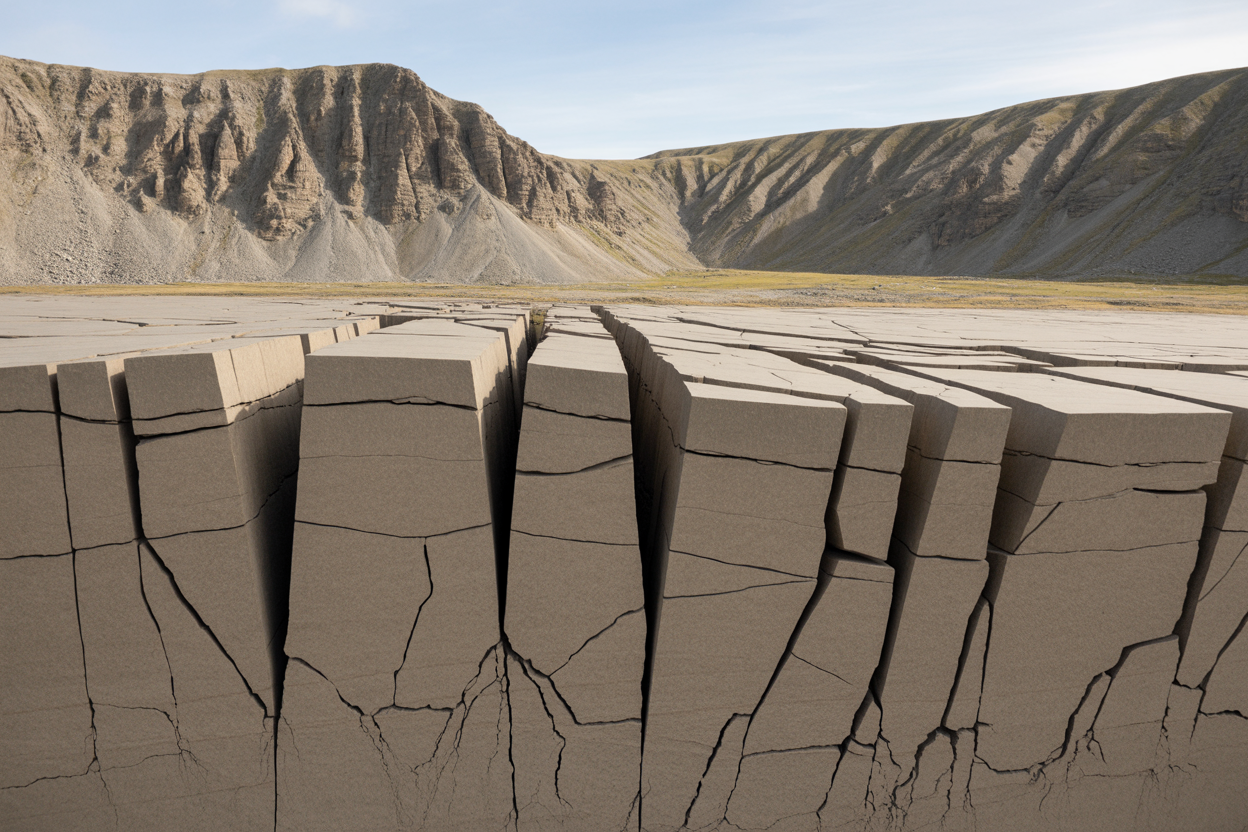
Block mountains form when massive sections of the Earth’s crust get pushed up or drop down along fault lines. Think of them as giant puzzle pieces that have shifted vertically from their original position. These geological giants aren’t created by folding like other mountain ranges – instead, they’re the result of the ground literally breaking and moving up or down.
The defining characteristic of block mountains is their steep, often cliff-like faces on one or both sides. These dramatic slopes mark where the fault lines occurred. Picture breaking a chocolate bar – the clean, sharp edges you see are similar to how block mountains appear in nature, though on a much grander scale.
To fully appreciate why are western ghats called block mountain, we must examine the geological dynamics.
Block mountains typically feature a relatively flat or gently sloping top surface called a horst, which represents the uplifted block. The areas that drop down between these raised sections are called grabens or rift valleys. This creates a distinctive landscape pattern of alternating high and low areas.
Faulting happens when stress in the Earth’s crust becomes too intense for the rock to handle. The crust essentially snaps along lines of weakness, creating fractures called faults. These breaks in the rock allow different sections to move independently.
Tectonic plates constantly push, pull, and slide against each other beneath our feet. When this movement creates tension that stretches the crust apart, normal faults develop. These are the primary type of fault responsible for block mountain formation. As the crust stretches, some blocks sink down while others remain elevated or even get pushed higher.
The movement isn’t usually sudden or dramatic like in movies. Instead, it typically occurs over millions of years through countless small shifts and occasional larger movements during earthquakes. Each movement adds to the overall elevation difference between the raised and lowered blocks.
Uplift in block mountain formation works through differential movement along fault planes. When the Earth’s crust experiences extensional stress, it doesn’t all move uniformly. Some sections resist the downward pull while others give way and drop.
The uplifted blocks maintain their elevation relative to the surrounding areas that have dropped down. This relative uplift can be enhanced by continuing tectonic activity that gradually raises certain blocks even higher over geological time scales.
Erosion plays a supporting role by wearing away the softer rocks in the dropped areas faster than the harder rocks in the uplifted blocks. This process amplifies the height differences and creates the sharp contrasts we see in mature block mountain ranges. The combination of initial faulting, continued tectonic movement, and selective erosion shapes these mountains into their characteristic form with steep escarpments and relatively flat tops.
About 200 million years ago, our planet looked completely different. A massive supercontinent called Gondwana dominated the southern hemisphere, holding together what we now know as South America, Africa, Antarctica, Australia, Madagascar, and India. Picture this giant landmass slowly cracking apart like a jigsaw puzzle coming undone.
India sat snugly between Africa and Antarctica, sharing geological features and even similar fossils with these distant continents. The Western Ghats region was part of this unified landmass, experiencing the same climate and geological processes as eastern Africa. Ancient rock formations in both regions still show remarkable similarities today, proving their shared heritage.
As Gondwana began its dramatic breakup, enormous forces deep within the Earth started pulling the continents apart. This wasn’t a quick process – it took millions of years of gradual separation, creating massive rifts and valleys between the splitting landmasses.
The separation between India and Africa created one of the most significant geological events in Earth’s history. Deep crustal rifting began around 165 million years ago, as tectonic forces stretched and thinned the Earth’s crust along what would become the Indian Ocean.
This rifting process worked like a slow-motion explosion. The continental crust cracked along weak zones, creating parallel fractures that ran roughly north-south. As these cracks widened, massive blocks of rock dropped down between them, forming what geologists call graben valleys. Other blocks remained elevated, becoming the horst structures that define block mountains.
The Mozambique Channel, which now separates Madagascar from Africa, and the area between India and Africa became zones of intense crustal extension. The Western Ghats formed along the eastern edge of this rifting zone, where the Indian plate began its dramatic journey northward toward Asia.
Massive volcanic eruptions accompanied the continental breakup, fundamentally shaping the Western Ghats landscape. Around 66 million years ago, one of the largest volcanic events in Earth’s history occurred – the Deccan Traps volcanism. Imagine lava flows so extensive they covered an area larger than France, piling up in some places over 2,000 meters thick.
These weren’t explosive eruptions like Mount Vesuvius. Instead, fluid basaltic lava poured out from long fissures in the ground, creating layer upon layer of volcanic rock. Each eruption added another chapter to the geological story, building up the foundation that would later be carved into the Western Ghats.
The volcanic activity occurred in multiple phases:
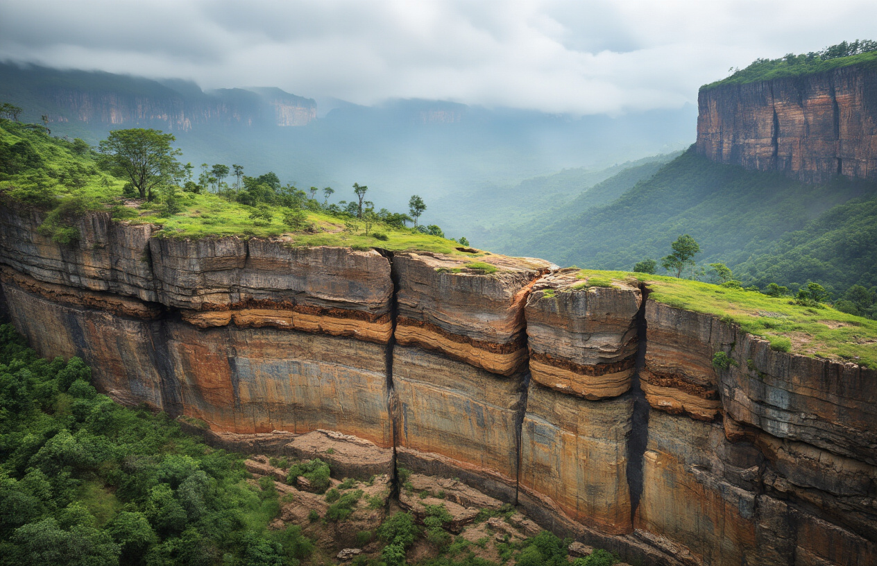
These lava layers cooled into distinct geological units, each with different resistance to erosion. The variation in rock hardness would later play a crucial role in shaping the dramatic escarpments and plateaus we see today.
The Western Ghats didn’t form overnight. Their story spans an incredible timeline that showcases the power of geological processes working over vast periods.
200-165 million years ago: Gondwana begins breaking apart, creating initial stress fractures in the crust where India connects to Africa.
165-120 million years ago: Active rifting separates India from Madagascar and Africa. The eastern edge of the Indian plate experiences intense faulting and block formation.
66-60 million years ago: The Deccan Traps volcanism floods the landscape with basaltic lava, creating the raw material for future mountain building.
60-30 million years ago: India races northward at remarkable speed (geologically speaking), while the newly formed volcanic plateau experiences its first phases of erosion and weathering.
30 million years ago to present: Continued erosion carves the dramatic escarpments we see today. Rivers cut deep valleys, exposing the layered structure that clearly shows the block mountain architecture.
The key insight is that the Western Ghats represent an ancient continental margin – the edge where India once connected to Africa. When the continents split apart, this margin was left as an elevated block, later enhanced by volcanic activity and shaped by millions of years of erosion into the spectacular mountain range we know today.
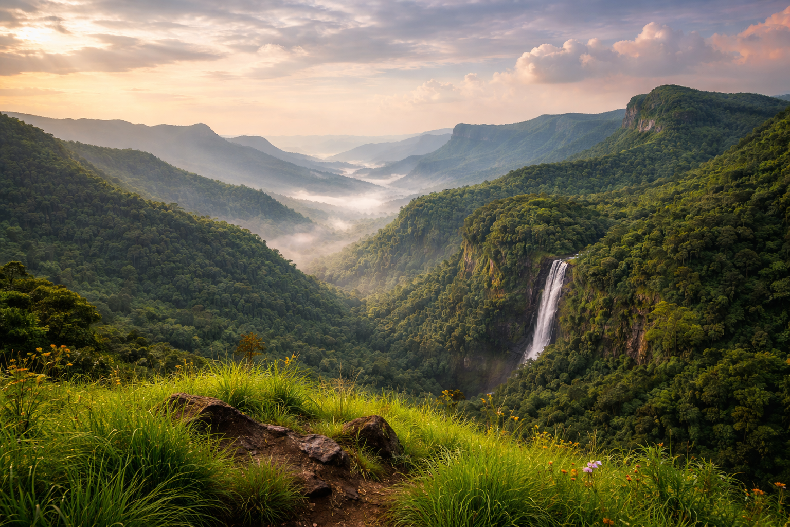
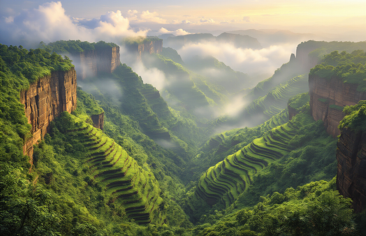
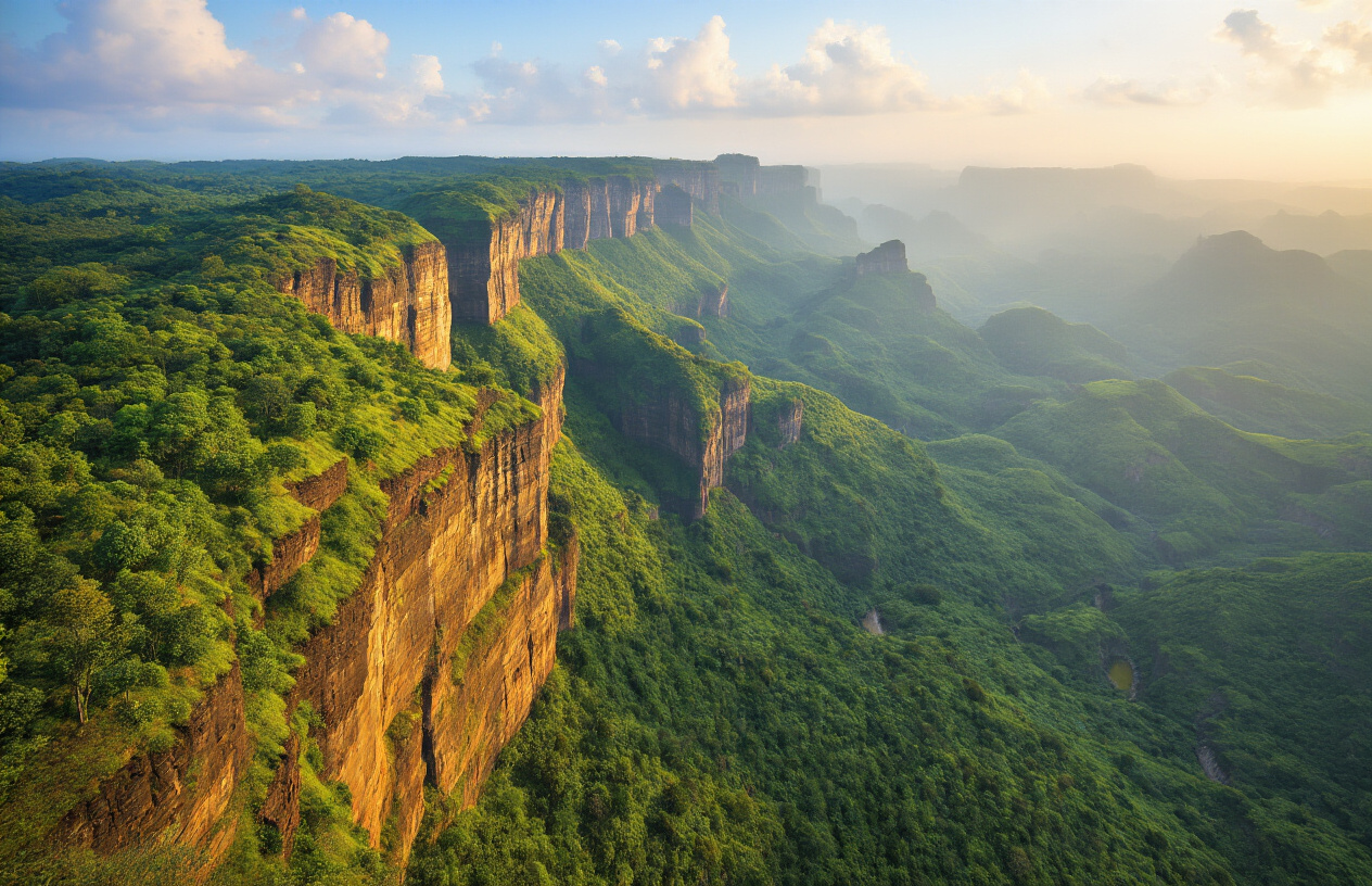
The most striking feature of the Western Ghats reveals their block mountain nature – the dramatic difference between their western and eastern faces. When you look at the Western Ghats from the Arabian Sea side, you’ll see towering cliffs that rise almost vertically from the coastal plains. These steep western slopes often reach heights of over 1,000 meters within just a few kilometers of the coast.
The eastern slopes tell a completely different story. They gently roll down toward the Deccan Plateau like a massive staircase, with gradual inclines that stretch for dozens of kilometers. This stark contrast happens because block mountains form when huge sections of the Earth’s crust tilt along fault lines. The Western Ghats tilted westward, creating the dramatic escarpment we see today.
You can spot this pattern throughout the entire mountain range – from the Sahyadri hills in Maharashtra down to the Cardamom Hills in Kerala. The western edge always drops sharply while the eastern side slopes away gradually. This consistent pattern across 1,600 kilometers of mountains provides clear proof of their block mountain structure.
The Western Ghats’ block mountain structure creates one of the most dramatic rainfall patterns in India. When moisture-laden monsoon winds blow in from the Arabian Sea, they hit the steep western escarpment like a wall. This abrupt rise forces the air masses upward rapidly, causing what meteorologists call orographic precipitation.
As the air climbs the western face, it cools quickly and releases massive amounts of water. Places like Mahabaleshwar and Agumbe receive over 250 inches of rainfall annually – some of the highest in the world. The eastern side tells a completely different story. Once the air crosses the plateau, it has already dropped most of its moisture, creating a rain shadow effect that leaves the Deccan Plateau much drier.
This rainfall pattern exists because of the block mountain’s fault-formed structure. The western edge drops sharply toward the coast, creating an almost vertical barrier that maximizes the orographic effect. Other mountain ranges with gentler slopes don’t produce such extreme rainfall differences across their width.
The tilted plateau structure of the Western Ghats acts like a massive sloped roof, directing water flow toward the east. Most rivers born in these mountains – including major ones like the Krishna, Godavari, and Cauvery – flow eastward across the Deccan Plateau before reaching the Bay of Bengal.
This happens because the Western Ghats formed as a tilted block during the rifting process. The western edge lifted higher while the eastern side remained lower, creating a natural gradient. The average elevation drops from about 3,000 feet at the western edge to around 1,500 feet on the eastern plateau.
Only a few short rivers manage to flow west into the Arabian Sea. These coastal rivers like the Netravati and Sharavati have steep, short courses because they must rush down the abrupt western face. The eastward-flowing rivers enjoy longer, gentler paths across hundreds of miles.
| Flow Direction | Examples | Distance Covered | Characteristics |
|---|---|---|---|
| Eastward | Krishna, Godavari, Cauvery | 800-1,500 km | Long, meandering courses |
| Westward | Netravati, Sharavati | 50-200 km | Short, steep, rapid flow |
The flat-topped plateau structure of the Western Ghats creates distinct ecological zones that support incredible biodiversity. These tablelands, called laterite plateaus, develop unique seasonal pools during monsoons that dry up completely in summer. This creates specialized habitats for endemic species that have adapted to these extreme conditions.
The plateau’s block mountain structure produces three main ecosystem types. The western slopes receive heavy rainfall and support dense tropical evergreen forests with species like teak and rosewood. The plateau tops experience seasonal extremes, hosting grasslands and scrub forests adapted to both flooding and drought. The eastern slopes, being drier, support deciduous forests that shed leaves during dry seasons.
Many studies highlight why are western ghats called block mountain due to their distinct features.
Many endemic species exist nowhere else on Earth because of these isolated plateau habitats. The block mountain structure created geographic barriers that allowed species to evolve separately on different plateaus. Purple frogs, Nilgiri tahrs, and hundreds of unique plant species developed in these island-like environments.
The steep escarpments also create microclimates at different elevations. Temperature drops about 3°F for every 1,000 feet of elevation gain, allowing tropical species to coexist with temperate ones within short distances. This vertical zonation multiplies the number of ecological niches available, explaining why the Western Ghats contain 30% of India’s species despite covering only 6% of its land area.
In conclusion, understanding why are western ghats called block mountain is crucial for appreciating their role in biodiversity.
Ultimately, the reason why are western ghats called block mountain shapes both the landscape and the ecosystems present.
The Western Ghats stand as a perfect example of block mountain formation, created millions of years ago when massive sections of the earth’s crust tilted and uplifted along fault lines. The geological evidence is clear – from the steep escarpment facing the Arabian Sea to the distinct stepped plateaus that characterize the entire mountain range. These features tell the story of how tectonic forces shaped one of India’s most important geographical landmarks.

[…] Block mountains due to faulting […]